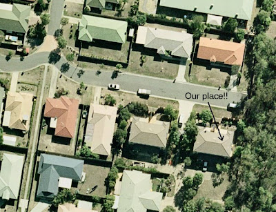
 Brisbane City Council have provided me with aerial photography for their entire council area. Not only is this a huge area (Brisbane City Council is the largest metropolitan council in Australia), but the resolution of the imagery is 15cm! This means that each pixel is 15cm x 15cm, allowing a detailed assessment of habitat at an amazing resolution! See this example image that is of our new place, which is the !
There are three main ways that aerial photography is provided; all of which vary in their degree of work required to produce a final photo array and all of which vary in their eventual accuracy.
1) A third of all photos are already orthorectified when I receive them; Brisbane City Council’s photos (thankfully) fall into this category. What this means is that I open them, and they fit nicely onto a map with their spatial co-ordinates accurately presented.
2) Then, almost two thirds of aerial photos are static images that I have to stitch to the framework myself, although luckily this sort of photo has an additional ‘tab’ file that states what the SW, NW, NE and SE co-ordinates of the photo are. You then instruct the program to move the corners of the photos to the given spatial co-ordinates. This is still a very time-consuming exercise, and the other day, I spent over 6 days (including a lot of weekend time) performing this exercise on 380 photos for the entire 1996 Gold Coast Council area…
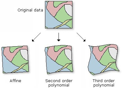
 3) The third way that aerial photography is provided is literally static images with no reference to where they belong. With these photos, you basically have to match a given image feature (i.e., road intersection, driveway-road intersection, building corner) with a known spatial co-ordinate. So for example, if I have an aerial photo of my neighbourhood, and I know (using my GPS unit) that the corner of my street is 27.607° S, 153.074° E, I designate that ‘control point’ on the aerial photo, as that known spatial co-ordinate. The more control points that you do this with, the more accurate your image will reflect reality. This process of ‘orthorectifying’ is also known as ‘rubber-sheeting’ once you have enough matching points on the photo. Through a process called ‘1st order polynomial’ and ‘2nd order polynomial’ transformations, parts of the aerial photo are effectively stretched and contracted to best match their true spatial location; thus the term ‘rubber-sheeting’. The image on the right shows what I mean, and comes from the ArcGIS help webpage. THIS method of orthorectifying is the most time consuming and inaccurate method, as the manipulation of the photo based on your control points is like laying a sheet over the ground and while you may be able to relatively accurately anchor parts of that sheet to the ground (control points), those parts of the sheet between the points are not necessarily where they should be. In the end, you can reduce the ‘error’ between the aerial photo and where you say those control points should be by just increasing the number of control points....... all depends on how accurate you need the data to be…
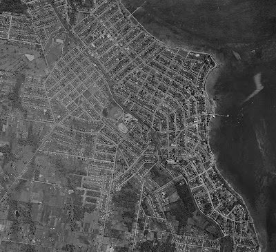
I have pasted below an interesting collection of photos from the Manly region of Brisbane. It shows a 2007 image (provided as a pre-orthorectified, according to the type 1 process as described above) image) of the region, and then a 1991 image (orthorectifying myself according to the type 3 process as described above), and finally a 1958 image that I managed to get my hands on and self orthorectify. It shows nicely the increase cover of development and reduced cover of native vegetation over 50 or so years! If you save them all and view them as a slideshow, you can see how you can accurately stitch photos on top of each other!


No comments:
Post a Comment